The drought which has been affecting Cuba since 2014 has had an significant impact on the country’s water resources, agriculture and other economic activities.
However, the start of the rainy season now begs the question whether this marks an end to the country’s dry spell.
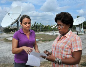
To explain the situation and other issues, Granma International spoke with Cecilia Fonseca Rivera (CFR), Meteorological Sciences PhD and researcher at the Meteorological Institute’s National Weather Center; as well as Marieta Hernández Sosa (MHS), Geography graduate and head of the institution’s weather surveillance team.
Lets talk first about the drought…
CFR— Weather in Cuba from 2015 to 2016 has been affected by the impact of two important events occurring at the same time: firstly the El Niño Southern Oscillation (ENSO) cycle, which is important given the extreme weather anomalies it produces throughout the entire region, and the drought which began in the 2014 rainy season.
This period was characterized by below average accumulated rainfall levels in the country’s western region, with the drought then spreading to the central and eastern part of the island. When we entered the dry period (November 2014-April 2015) there was a shortage of rainfall across approximately 66% of the country, representing the fourth driest period since 1961 for the island’s western region.
Then came the 2015 rainy season (May-October), which also saw below average rainfall levels for the largest island in the Greater Antilles. Meanwhile the westernmost region of the country continued to be the worst affected. The result: a severe drought following three consecutive months of below average rainfall for the period.
Afterwards, we entered into the dry period which recently concluded last month (November 2015-April 2016). Generally speaking this phase ended on a high. Even from October total rainfall has been substantial.
What has been affecting rainfall levels?
CFR— Rainfall levels are essentially associated with processes of atmospheric circulation which were consistent with the effects of El Niño. This phenomenon began in March 2014, reaching its peak at the end of the year, declining from then through November-December 2015, and is currently continuing to decline. Results of climate models suggest that everything is returning to normal.
Twenty-eight new highs were recorded by Meteorological Institute weather stations in April 2015. Photo: Jorge Luis González
The El Niño weather pattern occurs in the equatorial Pacific Ocean and refers to ocean-atmosphere climate interaction linked to a periodic warming in sea surface temperatures, an event which affects almost the entire planet.
The weather phenomena which occurred during the months of November, December and January, were the result of abnormal conditions caused by El Niño.
What kind of weather can we expect to see from May-October 2016?
MHS— About 80% of the country’s total yearly rainfall occurs during Cuba’s rainy season. The rains start in the east of the island, then move toward the center and start to fall in the west around the end of May. They are generally the result of tropical hurricanes.
You must bear in mind that the current rainy period is affected by the retreat of the El Niño Southern Oscillation. Its decline in the equatorial Pacific Ocean normally coincides with a decrease in rainfall.
However, for the August-September-October period climate models indicate a strong probability of above average rainfall. The majority of El Niño models predict the future development of the La Niña phenomenon, in the equatorial Pacific. This usually impacts the hurricane season resulting in increased activity over the period.
Thus we could see close to average rainfall for the months of May to June, and close to or higher than average levels from August to October.
With El Niño in retreat and La Niña approaching, will this bring enough rainfall?
CFR— In Cuba’s case the effects ofEl Niño are most prevalent with increased rainfall during the dry season. Studies carried out thus far at the Weather Center have shown that El Niño is not associated with droughts. Drought is a multi-causal event linked to processes which range from insufficient precipitation producing mechanisms to little atmospheric humidity.
When an extreme weather event starts to decline, it is usually followed by a very dry rainy period.
Given the lack of rainfall, even if the country reaches average rainfall levels, this still won’t be sufficient to relieve the current deficit.
If predictions are correct for the three month period of August-September-October, and we see above average rainfall, this could definitely help to alleviate our current situation.
Are El Niño and La Niña cyclical weather events? Do they alternate?
CFR— El Niño and La Niña are the same phenomenon, the first is linked to above-average sea surface temperatures while La Niña is the opposite, that is to say it is caused by below-average sea surface temperatures in the equatorial Pacific Ocean. They are two different stages of the same event.
In Cuba’s case La Niña mainly affects tropical hurricane activity. Meanwhile, El Niño prevents hurricanes from forming in the Atlantic Ocean, whereas La Niña stimulates the process.
Any unexpected figures recorded last year?
MHS— We can tell you about how temperatures have behaved during 2015. That year we saw the highest average temperature recorded from 1951 to date.
This was due to global warming and was also influenced by the El Niño Southern Oscillation. Said high also caused above-average temperatures around the rest of the country for almost all of 2015, mainly during the summer months in the west of the island.
<>(Granma)